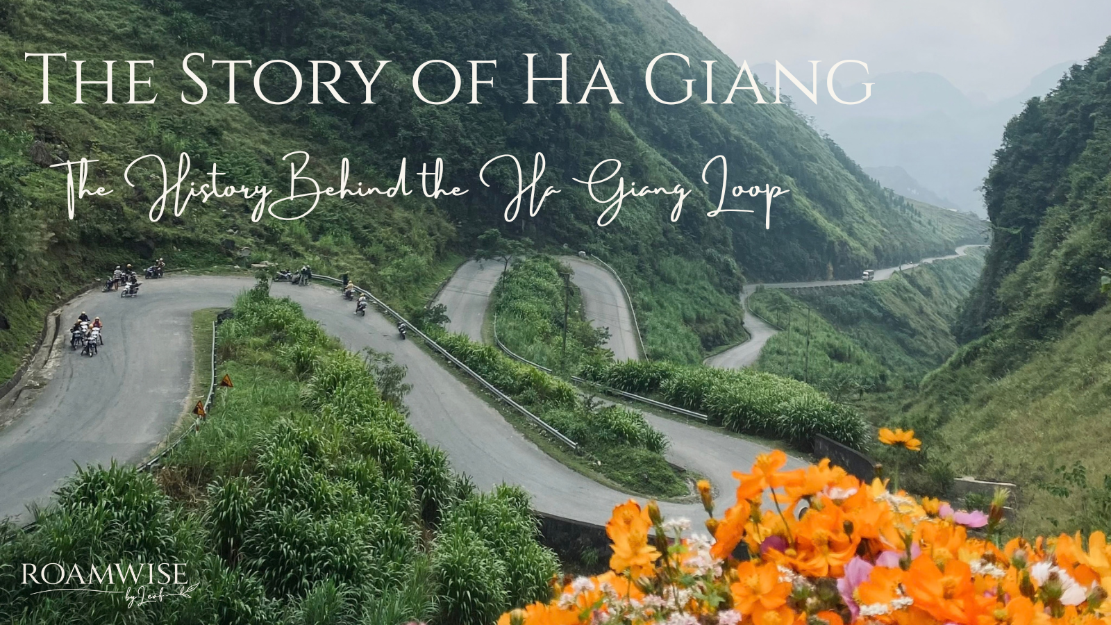
Most people visit Ha Giang for the road.
The famous mountain passes, the Nho Quế River, and the winding route through northern Vietnam have made the Ha Giang Loop one of the country’s best-known adventures. But the road is only a small part of the story of Ha Giang.
Ha Giang has been shaped by thousands of years of settlement, generations of ethnic communities, its position on Vietnam’s northern frontier, colonialism, and one remarkable road-building project that changed the region forever.
I’ve always found the people there to be one of the best parts of Ha Giang. They’re friendly, funny and charming, but what I particularly love is how connected people are to the land and its history.
So, if you’re planning to ride the Ha Giang Loop, I think it’s worth understanding the story of Ha Giang and what came before the road.
Because once you know the story behind the road, you see Ha Giang differently.
Before You Ride the Ha Giang Loop
After doing the Loop more times than I can count, here’s how I’d approach it:
How long? 4 days if you can. Three works, but four gives you more time to enjoy the route.
Ride yourself? Only if you’re confident and properly licensed. Otherwise, I’d choose an Easy Rider.
Group tour or private? I’d choose a reputable small-group tour or private guide, ideally with a cultural or community focus.
Who to go with? Friends or family if you can. It’s the sort of trip you’ll have plenty to laugh about afterwards.
Travelling solo? Absolutely — just be sensible with the rice wine. You don’t have to accept every glass.
The Story of Ha Giang Began Long Before the Loop
The story of Ha Giang began long before the Loop. The Ha Giang of today is relatively new, but the people who live there are not.
Archaeological evidence around Ha Giang City shows human activity in the region stretching back tens of thousands of years. Over the centuries, different communities developed across the mountains, adapting their lives to a landscape that is beautiful but far from easy to live in.
Today, the region is home to numerous ethnic groups, including Hmong, Tay, Dao, Nung, and Lo Lo communities.
That diversity is one of the first things I think you should understand about Ha Giang.
When you’re riding through the mountains, it’s easy to think of the villages, fields, and houses as part of the scenery. They’re not. This is a lived-in landscape that has been shaped by generations of people.
The mountains influenced where communities settled, how they farmed and how they travelled. Markets became important meeting places, bringing together people from different villages and ethnic groups.
And because Ha Giang sits right on Vietnam’s northern frontier, its history has always been tied to more than just the mountains around it.
Rice farming continues to shape the landscape and daily life across much of the region. If you’re visiting after the harvest, it’s worth understanding what happens during Vietnam’s agricultural burning season, when farmers clear leftover crops from their fields.
The Hmong Lords of Ha Giang
One of the most fascinating chapters in Ha Giang’s history is the story of the Hmong lords who ruled parts of the northern mountains.
The Hmong have had a strong presence in the region for centuries, particularly around Đồng Văn and Mèo Vạc. The Vương family eventually became one of the most powerful families in the area.
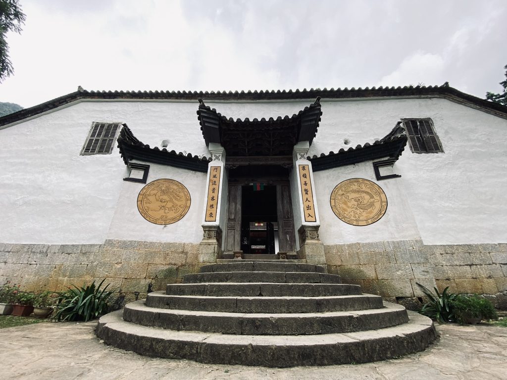
This is still visible in Sà Phìn, where you can visit the Vương Family Mansion, or the Hmong King Palace as it is also known.
I’d recommend stopping here on the Loop, particularly if you know a little about what you’re looking at.
The mansion was built in the early 20th century for Vương Chính Đức, a Hmong leader who became known as the Hmong king. Construction began around 1902–1903, and the complex combines Hmong, Chinese, and European influences.
It’s a surprisingly imposing building for such a remote mountain valley, with courtyards, stone walls, wooden railings, and numerous rooms arranged around the main complex.
But the building itself isn’t really the most interesting part, it’s what happened around it.
Vương Chính Đức had a complicated relationship with the French colonial authorities, who recognised his influence and gave him a military rank. After his death in 1944, his son Vương Chú Sển eventually supported Hồ Chí Minh and the revolutionary government.
So this one mountain mansion sits right in the middle of several layers of Ha Giang’s history: Hmong leadership, Chinese influence, French colonialism, and the creation of modern Vietnam.
Once you know that, it stops being just another pretty old building to photograph.
Ha Giang and the French Colonial Period
Ha Giang’s position on the Chinese border has shaped its history for centuries.
The French occupied Ha Giang in the late 19th century, and in 1891 the area was formally established as a province under French colonial administration.
The French developed a military presence in the region, but their control was far from uncontested. There was resistance to French rule, including uprisings led by local Dao communities in the early 20th century.
Ha Giang was never simply a remote corner of Vietnam that happened to be difficult to reach. Its location made it a frontier.
It sat close to China and far from the centres of government further south, and that isolation shaped the region for generations.
Eventually, though, one enormous infrastructure project would begin to change that.
The Happiness Road Changed Everything
If there is one part of the story of Ha Giang I think every visitor should know, it’s the building of the Happiness Road.
Today, you’ll know it as the route through some of Ha Giang’s most spectacular scenery. But it wasn’t built for tourists.
Construction began in 1959, with the aim of connecting Ha Giang City with the remote northern districts of Quản Bạ, Yên Minh, Đồng Văn, and Mèo Vạc.
Before the road, travelling through this mountainous region was extremely difficult. Communities were connected by footpaths and rough routes, and some journeys could take days.
Thousands of workers and young volunteers began building a road through the mountains. Much of the work was done by hand, cutting and moving rock through incredibly difficult terrain.
The project took around six years and was completed in 1965.
It became known as Con đường Hạnh Phúc — the Happiness Road, reflecting the belief that better connections would bring greater access to education, healthcare, trade, and opportunities for the communities living in the mountains.
And nowhere is the scale of that project more obvious than at Mã Pí Lèng.
Mã Pí Lèng: The Road Through the Mountains
The most famous section of the Happiness Road is probably Mã Pí Lèng Pass.
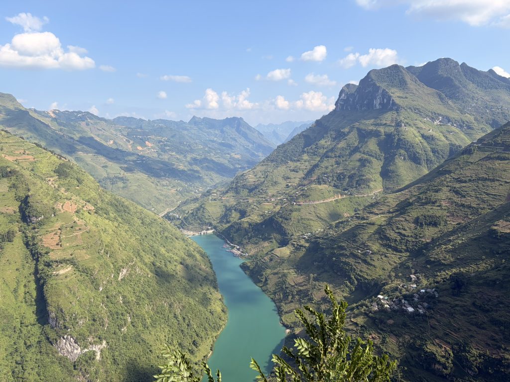
Today, it’s one of the defining images of the Ha Giang Loop. The road cuts across the limestone mountains high above the Nho Quế River, and the views are every bit as impressive as you’ve probably seen online.
But Mã Pí Lèng is also where the scale of the original road-building project really becomes obvious.
Workers had to carve a route through steep limestone cliffs to connect communities that had previously been extremely isolated.
So when you’re standing at the viewpoint, look beyond the view.
Look at the road itself and where it has been cut into the mountain. Then remember that people created that route decades ago using far more basic tools than we have today.
That’s the bit that stays with me.
The famous photographs are beautiful, but knowing how the road came to exist makes the experience much more meaningful.
Ha Giang’s Development from Isolated Mountains to a UNESCO Geopark
The region’s geology is another important part of its story.
The Đồng Văn Karst Plateau became Vietnam’s first UNESCO Global Geopark in 2010. The landscape is dominated by ancient limestone formations, with geological evidence dating back hundreds of millions of years.
But what interests me more than the geology itself is how people have adapted to it.
This is not easy farming country. Communities have had to make a living on steep, rocky terrain, developing ways of growing crops and living within the limitations of the landscape.
The result is a place where the natural and human landscapes are closely connected.
That’s why I don’t particularly like describing Ha Giang as “untouched”, because it isn’t.
People have been living, farming, and building communities here for generations. In that sense the landscape can’t be untouched.
So When Did the Ha Giang Loop Become Famous?
This is the surprisingly recent part of the story.
The road is decades old. The mountains are ancient. The Ha Giang Loop as an international travel experience is relatively new.
There isn’t one specific moment when somebody invented the Loop. As roads improved and independent travellers began exploring further into northern Vietnam, the route gradually became known among backpackers.
By the 2010s, international travellers were increasingly discovering Ha Giang as an alternative to Vietnam’s more established tourist destinations.
Then social media accelerated everything.
Photographs of Thẩm Mã Pass, Mã Pí Lèng, the Nho Quế River, and endless mountain roads spread across Instagram, YouTube and travel blogs.
More travellers arrived, tour companies developed, motorbike rentals became easier, and homestays opened along the route.
The Ha Giang Loop became a destination in its own right.
What’s fascinating to me is how quickly the story of Ha Giang changed compared with everything that came before it.
For centuries, the mountains made Ha Giang difficult to reach.
The Happiness Road changed that.
And within a few decades, people from all over the world were travelling here specifically because of the road.
If you’re looking for an alternative route, read my Northern Vietnam Travel Guide here.
The People Are Part of Ha Giang’s Story
It would be very easy to spend four days on a motorbike, tick off the famous viewpoints, and leave thinking you’ve “done” Ha Giang.
You haven’t. You’ve experienced one route through it.
The region is still home to communities with their own languages, traditions, markets, festivals, farming practices, and family histories. The people aren’t background props for a motorbike adventure.
I’ve found people in Ha Giang to be welcoming, curious, and incredibly self-sufficient, but what stands out most is how much people know about where they live. There is a genuine connection to the land and a pride in its history that you notice when you spend time here.
Some of my favourite parts of visiting Ha Giang have had nothing to do with the famous viewpoints. It’s the conversations, sitting down for food, being introduced to someone’s family, or listening to a guide explain the story behind somewhere you’d otherwise have simply driven past.
I once visited a particularly remote village with a guide who couldn’t communicate with the people we met there. They were so self-sufficient and isolated that they hadn’t needed to learn Vietnamese — they spoke their own local language instead. It was a good reminder of just how distinct some of the communities across these mountains are, even from one village to the next.
That’s why a good guide can make such a difference. They can explain what you’re seeing rather than simply pointing towards the next viewpoint.
You don’t need to turn your trip into a history lesson. Just be interested in the place you’re travelling through.
I’ve written more about the importance of festivals and traditions in Vietnam in my guide on the story behind Vietnam’s Mid-Autumn Festival.
How I’d Experience the Ha Giang Loop
After doing the Ha Giang Loop many times, I know exactly how I’d choose to experience it: a small-group tour with an Easy Rider.
I like the social element of travelling in a group, but I’d look for a smaller one, ideally with a cultural or charity focus that takes you beyond the busiest parts of the Loop.
You can self-drive, but you need the right licence, confidence, and experience on mountain roads. There’s also Vietnam’s zero-alcohol policy for drivers, and honestly, I’d rather not spend the day wondering what’s around the next bend.
I’d choose an Easy Rider every time. Feeling safe is important to me, but I also love spending several days with a local person, talking about their life and family, and getting to know the person showing you their home.
Whichever option you choose, I’d book through a reputable company rather than choosing purely on price. The right guide can make the difference between simply riding the Loop and actually getting to know Ha Giang.
And yes, enjoy the rice wine (Happy Water) — just remember that you don’t have to accept every glass.
💡Roamwise Tip
Tipping your Easy Rider well at the end is a small but meaningful way of giving something back.
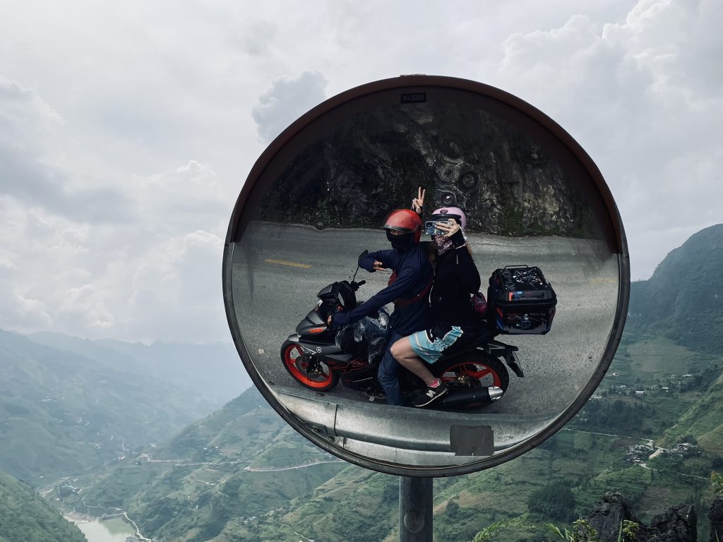
The Ha Giang Loop Today
The Ha Giang Loop in 2026 looks very different from the road of the 1960s.
There are better roads, more accommodation, more restaurants, more tour operators, and significantly more international visitors.
The route is now firmly established on Vietnam’s backpacking circuit, and social media has made some of its viewpoints instantly recognisable around the world.
That has made Ha Giang much easier to visit, but it has also changed the character of the journey. The busiest sections can now be full of tour groups, particularly during peak periods, and the areas around some of the more famous viewpoints have become more developed.
But the mountains haven’t changed and neither have the communities that have called them home for generations.
And that’s what I find interesting about the Loop today. You’re travelling along a road that was built to connect remote communities, but you’re now travelling it as part of an international tourism industry that barely existed here a few decades ago.
The contrast is hard to miss.
If you’re travelling to Vietnam for the first time, these are 23 things I wish I’d known before I went.
Ha Giang’s Story Is Still Being Written
Ha Giang’s history doesn’t stop with the Happiness Road or the arrival of international tourism.
The region is still changing, and tourism is now part of that story. It has brought income, jobs, and opportunities, but it also puts pressure on the places and communities along the route.
That’s why I think the way we travel here matters. Ha Giang isn’t a backdrop created for visitors; it’s home to people who have lived here for generations. Respect people’s homes and traditions, support local businesses, and remember that the most photographed places aren’t necessarily the most important ones.
There’s another recent change worth knowing about.
In June 2025, Vietnam reorganised its provincial administrative system, reducing the country to 34 provincial-level administrative units. Ha Giang and Tuyên Quang were merged into the new Tuyên Quang Province, which began operating under the new system on 1 July 2025.
For travellers, this doesn’t mean the Ha Giang Loop has disappeared. The name Ha Giang remains deeply rooted in the region’s identity and in international travel.
But historically, it’s another reminder that places aren’t fixed.
Borders change. Names change. Roads change. Tourism changes.
And Ha Giang has been changing for centuries.
FAQs About Ha Giang and the Ha Giang Loop
How old is Ha Giang?
The human history of the Ha Giang region stretches back thousands of years, with archaeological evidence near Ha Giang City dating back tens of thousands of years. The modern province, however, went through numerous administrative changes before becoming Ha Giang Province in its modern form.
What is the history of the Ha Giang Loop?
The roads used by today’s Loop are closely connected to the Happiness Road, a major road-building project constructed between 1959 and 1965. It connected Ha Giang City with the remote northern plateau districts and transformed access to communities that had previously been extremely isolated.
Why is the Ha Giang road called the Happiness Road?
The route is known in Vietnamese as Con đường Hạnh Phúc, meaning Happiness Road. The name is associated with Hồ Chí Minh, who visited the region in 1961 and linked the road with the opportunities and improved access it would bring to local communities.
When did the Ha Giang Loop become popular with tourists?
The modern Ha Giang Loop developed as a tourism experience much more recently than the road itself. International interest grew particularly during the 2010s as independent travellers began exploring the region by motorbike, with tourism continuing to expand as the route became better known internationally.
Who lives in Ha Giang?
Ha Giang is home to many ethnic communities, including Hmong, Tay, Dao, Nung and Lo Lo people. The Đồng Văn Karst Plateau UNESCO Global Geopark alone is home to 17 ethnic groups.
Is Ha Giang still a province in 2026?
No. In 2025, Ha Giang Province was merged with Tuyên Quang Province to form the new Tuyên Quang Province. The new administrative structure officially began operating on 1 July 2025. The historic region and the Ha Giang Loop, however, remain widely known by the name Ha Giang.
Is the Ha Giang Loop worth doing?
In my opinion, absolutely — but I’d do it for more than the scenery. The history, communities and people are what make the journey memorable. I’d take an Easy Rider and join a culture-focussed small-group tour, treating the journey as an opportunity to actually learn about the region.
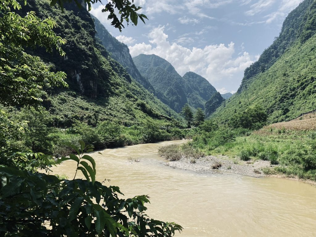
What I love about the story of Ha Giang is that the thing we travel there for — the road — isn’t actually the most interesting part.
The mountains were here first. People built lives around them, communities developed their own cultures and traditions, and eventually a road was carved through those mountains to connect them.
Now we’re riding it for fun. I think that’s worth remembering.
So yes, ride the Loop, take an unreasonable number of photographs, and enjoy the mountains. But talk to people too. Some of the best moments I’ve had in Ha Giang have come from simply sitting down and listening.
The Loop might be what gets you to Ha Giang. The story is what makes you understand it.
Roamwise by Leaf — Practical guides | Forgotten stories | Meaningful journeys