Category: History

  • Where Did Vietnam’s Ethnic Minority Groups Come From? 

    Where Did Vietnam’s Ethnic Minority Groups Come From? 

    Some of my favourite experiences in northern Vietnam have come from the people I’ve gotten to know along the way.

    I’ve shared meals and glasses of happy water with Dao and Tay friends, watched khèn performances in Lao Xa over hot Shan Tuyết tea, and learnt how Hmong women turn hemp into woven, indigo-dyed textiles in Lung Tam. In Ban Gioc, I’ve also discovered Nung An knife-making and incense-making traditions.

    The more I’ve experienced, the more curious I’ve become about where Vietnam’s ethnic minority groups came from and how their histories shaped the region.

    Northern Vietnam is home to many of these communities, each with its own identity and traditions. Although they’re particularly prominent in the mountain provinces, ethnic minority groups can be found throughout the country.

    So, who are these communities, how did they come to live in northern Vietnam, and what should travellers know about them?

    Understanding Vietnam’s Ethnic Minority Groups

    Vietnam officially recognises 54 ethnic groups. The Kinh, also known as the Viet, make up the majority, accounting for 85.3% of the population, according to the 2019 population census. The remaining 14.7% belong to 53 ethnic minority groups.

    According to the census, ethnic minority populations are concentrated mainly in the Northern Midlands and Mountainous regions and the Central Highlands, although communities live throughout the country.

    Their populations vary considerably. In 2019, six ethnic minority groups had more than one million people, while 11 had fewer than 5,000.

    Among the communities found in northern Vietnam are the Hmong, Dao, Tay, Nung, Lo Lo, Giay, and Pu Peo. Each has its own language, history, and cultural traditions.
    Where Did Vietnam’s Ethnic Minority Groups Come From?

    Vietnam’s ethnic minority groups don’t share one common origin. Some have long histories in the region, while others have migration histories connecting them to neighbouring parts of mainland Southeast Asia, particularly southern China.

    Long before today’s national borders existed, people moved through the valleys and mountain passes of this region, trading, farming, and forming communities. Political circumstances changed, and sometimes people moved again.

    Did Ethnic Groups in Northern Vietnam Migrate from China?

    For several communities, historical links with southern China are an important part of their origins.

    The Hmong are one of the clearest examples. Historical research traces migrations from southwestern China, particularly areas around Guizhou, into the mountainous regions of Vietnam, Laos and elsewhere in Southeast Asia.

    Larger movements took place during the 19th and early 20th centuries, influenced by conflict, political pressure and upheaval in China.

    The Dao also have historical connections with southern China. Their ancestors migrated south over several centuries, with different branches settling in northern Vietnam at different times. Today, Dao communities are found across several northern provinces, including Ha Giang, Lao Cai and Cao Bang.

    The Tay and Nung have particularly close historical and cultural connections with the Zhuang people of southern China, especially in Guangxi. Their languages belong to the Tai-Kadai family, and communities on both sides of the border have long shared cultural links. However, the Tay and Nung have developed their own distinct identities within Vietnam.

    The Lo Lo have another connection to the region. They are closely related to the Yi people of China, particularly communities in Yunnan and Sichuan. In Vietnam, they settled in parts of the far north, including areas around Dong Van and Meo Vac in Ha Giang.

    👉 These are examples rather than a complete account of every community. Migration histories are complex, and an ethnic group’s present-day identity doesn’t necessarily tell us exactly when or how its ancestors arrived.

    So, Was the Border Open?

    Not in the modern sense of an international border with immigration controls and official crossing points.

    For centuries, the mountains between northern Vietnam and southern China formed a connected borderland. Local communities traded, travelled, and maintained family relationships across the region. 

    Political boundaries and areas of influence existed, but they didn’t always resemble the clearly marked national border we see on a map today.

    That doesn’t mean the frontier was always peaceful or that people could move wherever they wanted. The region experienced periods of conflict, changing political control, and restrictions on movement.

    The modern China–Vietnam border began to take a more formal shape during French colonial rule, when the French government and the Qing dynasty signed border agreements in 1887 and 1895, helping to define the modern boundary between Vietnam and China.  

    Relations deteriorated sharply in the late 1970s, culminating in the 1979 border war. The frontier was heavily restricted, disrupting trade and contact between communities. Relations began to normalise in 1991, allowing local connections and trade to gradually resume.

    So, when we talk about communities migrating from China into Vietnam, we’re often describing movements that happened over generations, when the political geography of the region looked very different from today.

    Why Did Vietnam’s Ethnic Minority Groups Settle in the Mountains?

    There wasn’t one reason, and not every community settled in the same way.

    For some groups, migration was driven by conflict, political pressure or the search for somewhere to establish new communities. Others moved through existing trade and family networks, gradually settling in areas where land and resources were available.

    The northern mountains offered different opportunities depending on the landscape. Valleys provided space for wet-rice cultivation, while steeper slopes were better suited to other forms of farming, including maize and terraced rice fields. Forests, rivers, and trade routes also shaped how communities made a living.

    Over time, people developed ways of farming, building houses, producing textiles, and using local resources that suited their surroundings. They adapted to the places where they lived while maintaining languages, customs and identities passed between generations.

    This is part of what makes travelling through northern Vietnam so interesting. The differences you notice between villages aren’t simply decorative traditions; they’re connected to much longer histories of migration, settlement, and adaptation.
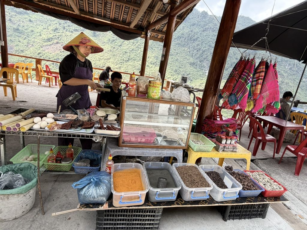
    Local people sell food at a roadside stall in Ha Giang

    Why Do Some Ethnic Groups in Vietnam Speak Different Languages?

    Vietnamese is the national language, but it’s not everyone’s first language. Many ethnic minority communities have their own languages, passed down through families and used in everyday life.

    These languages don’t all share the same origins. Hmong languages belong to the Hmong-Mien family, while Tay and Nung languages are part of the Tai-Kadai family. Lo Lo languages belong to the Sino-Tibetan family.

    Vietnamese is widely used in schools, government, and communication between different communities. Many people speak more than one language, although this varies between individuals and generations.

    For travellers, it’s a useful reminder that Vietnam isn’t linguistically or culturally uniform. You might hear several different languages during a journey through the northern mountains, sometimes within the same area.

    Who Are the Ethnic Minority Groups in Northern Vietnam?

    Northern Vietnam is home to dozens of ethnic minority communities, but there are a few you’re particularly likely to learn about when travelling through Ha Giang, Sapa, and Cao Bang.

    Their communities aren’t confined to individual towns or tourist destinations, and many live alongside other ethnic groups. However, certain areas are particularly associated with particular communities.

    Hmong People in Ha Giang and Sapa

    The Hmong are one of the largest ethnic minority groups in northern Vietnam, with communities spread across the mountainous provinces. 

    They’re particularly prominent in Ha Giang, including the districts around Dong Van, Meo Vac, and Yen Minh, as well as the Sapa region.

    Hmong communities have distinctive textile traditions, including indigo-dyed fabrics, embroidery and decorative clothing. Farming is also important in many areas, with families adapting their crops and methods to the mountainous terrain.

    You can read more about Ha Giang’s history and how its communities shaped the region. 

    Dao People in Ha Giang and Sapa

    Dao communities are found throughout northern Vietnam, including Ha Giang and the mountains around Sapa. 

    Many have traditionally settled in higher mountain areas and on steep slopes, although this varies between different Dao groups. One particularly well-known community is the Red Dao of Ta Phin village, outside Sapa. 

    Their distinctive red headdresses, embroidered clothing, and traditional herbal bathing practices are among the things the community is known for. 

    In Ha Giang, Dao communities also maintain important ceremonies, including the cấp sắc  rite of passage for men in some Dao groups.

    Tay People in Ha Giang

    The Tay have a long-established presence in Ha Giang and neighbouring northern provinces. Traditionally, many Tay communities settled in valley floors and lower-lying areas, where flatter land and access to water made wet-rice farming possible.

    Stilt houses are a familiar feature of many Tay villages, while hát Then, a traditional form of ritual singing accompanied by the đàn tính lute, remains an important part of their cultural heritage.

    Lo Lo People Around Lung Cu

    The Lo Lo are one of Vietnam’s smaller ethnic groups, with communities mainly in the far northern provinces of Ha Giang and Cao Bang.

    One of the best-known places to learn about Lo Lo culture is Lo Lo Chai, a village just below Lung Cu Flag Tower in the Dong Van area. The village is known for its traditional rammed-earth houses, colourful embroidered clothing, and family-run homestays.

    👉 It’s a particularly interesting stop on the Ha Giang Loop if you want to learn more about one of the region’s smaller communities.

    You can find more places to visit in my Northern Vietnam travel guide. 

    Nung People in Cao Bang

    The Nung are found across several northern provinces, but Cao Bang is particularly associated with the Nung An subgroup. 

    Two villages offer a glimpse into their traditional craftsmanship. Phuc Sen is known for its blacksmithing and handmade knives, while nearby Phia Thap is associated with traditional incense production.

    Both crafts have been passed down through generations and remain an important part of local livelihoods. They’re also a reminder that cultural heritage isn’t always found in clothing or ceremonies; sometimes it’s in the practical skills and knowledge people use every day.
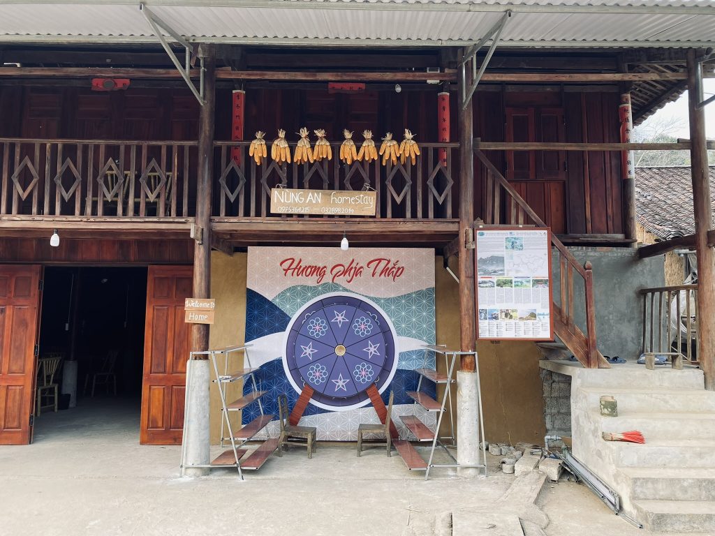
    Phia Tap Village in Cao Bang is home to the Nung An peoples
    Phia Tap Village in Cao Bang Province is home to the Nung An ethnic minority group

    What Is Everyday Life Like in Northern Vietnam’s Ethnic Communities?

    It’s easy to focus on the things that make different communities visually distinctive: traditional clothing, houses, farming methods, and ceremonies. But everyday life is about much more than cultural traditions.

    Across northern Vietnam, people work, raise families, attend school, and make decisions about their futures. Some households rely on agriculture, while others earn a living through tourism, trade, crafts, or employment in nearby towns.

    Farming, Family, and Work

    Agriculture remains important in many mountain communities. Depending on the location, families may grow maize, cultivate rice, raise livestock, or produce goods for local markets.

    Farming can be physically demanding, particularly where steep terrain makes cultivation difficult. However, livelihoods are changing, with younger generations increasingly pursuing opportunities through education, tourism, and employment outside their home villages.

    Food, Celebrations, and Social Gatherings

    Weddings, festivals, harvest celebrations, and religious ceremonies bring families and neighbours together. Food, music, happy water, and traditional customs all play a role, although the details vary between communities.

    Something I’ve found interesting about travelling in northern Vietnam is how much importance people place on coming together. There’s a social side to mountain life that you might not appreciate if you’re simply passing through on a motorbike.

    Traditions and Changing Generations

    Culture doesn’t stand still. Some younger generations continue learning traditional crafts, languages, and ceremonies, while others move to larger towns for education or work. Traditions adapt as communities balance their cultural heritage with changing opportunities and modern life.

    For me, understanding northern Vietnam means being curious about its traditions while recognising that the people who live here are navigating a changing world, just like everyone else.
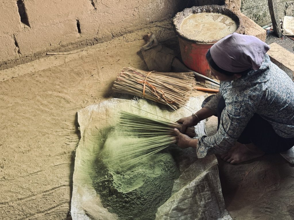
    A woman adds colour to incense sticks in Phia Tap village, Cao Bang
    If you want to see local ethnic minority groups try exploring traditional craft villages

    Where Can You Experience Northern Vietnam’s Ethnic Cultures?

    If you’re travelling through northern Vietnam, there are plenty of opportunities to learn about local communities. But I think the way you approach these experiences matters just as much as where you go.

    Rather than rushing through a village to take a few photographs, look for opportunities to spend time, listen, and learn.

    Visit a Local Market

    Markets are interesting places to see different aspects of everyday life. People come to buy and sell produce, exchange goods, meet friends, and catch up with people from neighbouring villages.

    Depending on where you visit, you may see traditional clothing, locally produced textiles, fresh food, livestock, and handmade household goods.

    Markets can be particularly lively on designated market days, when people travel from surrounding villages to trade and socialise. They’re also a reminder that these places aren’t simply cultural attractions. They’re working markets serving the communities around them.

    Stay in a Locally Run Homestay

    A locally run homestay can offer a different perspective from staying in a conventional hotel. You may have the opportunity to share meals, learn about local ingredients, and get a better understanding of everyday life in the area.

    However, the word homestay can mean different things, so it’s worth looking into who actually runs the property and whether the income benefits the local household.

    Don’t expect every homestay experience to involve traditional clothing, elaborate ceremonies, or a perfectly curated cultural experience. Sometimes the most interesting part is simply having time to enjoy a meal, chat with your hosts, and see a little more of the place you’re visiting.

    Explore Traditional Craft Villages

    Traditional crafts are still part of everyday life in parts of Cao Bang. For the people keeping these skills alive, they’re not simply cultural demonstrations; they’re also livelihoods, often passed down through generations.

    Some craftspeople are happy to show visitors how they work and explain the techniques involved, while others are busy with their daily work. I think there’s something particularly interesting about seeing these traditions in their everyday setting, rather than as a performance put on for tourists.

    👉 If you find something you’d like to take home, buying directly from the maker is a lovely way to support the people keeping these crafts going.

    Choose Community-Led Trekking and Local Guides

    A knowledgeable local guide can add a great deal to a journey through northern Vietnam. They may be able to explain the history of a village, introduce you to local traditions, and help you understand things you might otherwise pass without noticing.

    In areas such as Sapa, guided village walks and community-based trekking with local women provide opportunities to learn about life beyond the main town.

    In Ha Giang, the communities you encounter will depend on your route. Travelling through the Dong Van area, for example, offers opportunities to learn about the Lo Lo, while other parts of the region have their own mix of communities and traditions.

    👉 Where possible, look for experiences led by local people and ask how the activity benefits the community.
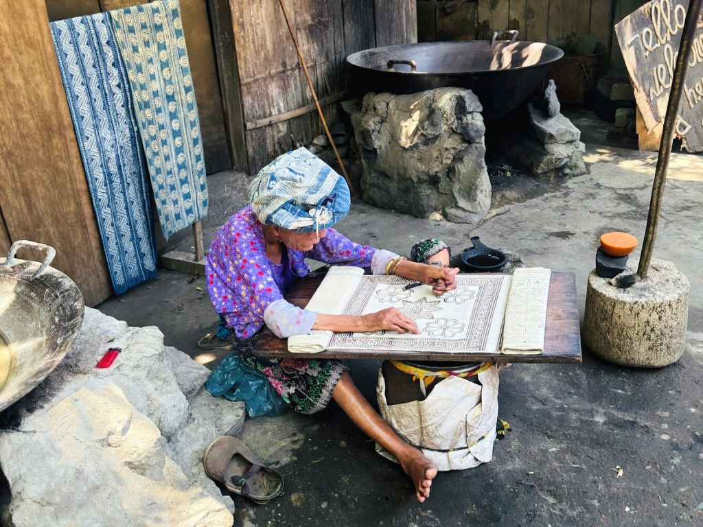
    An elderly lady belonging to the Hmong ethnic minority group is working at a hemp village in Ha Giang

    How to Visit Vietnam’s Ethnic Minority Groups Respectfully

    You don’t need to know every custom before visiting a village, but a little thought goes a long way. A few things I always think are worth remembering:

    • Respect privacy and ask permission. Don’t assume someone is happy to be photographed because they’re wearing traditional clothing or selling goods at a market. The same applies to entering someone’s home, photographing private spaces, or asking personal questions. A friendly gesture or question can make all the difference.
    • Choose local guides where possible. Someone from the community may be able to explain local life in ways you won’t get from simply walking through a village.
    • Buy crafts thoughtfully. If you’re interested in textiles, incense, or metalwork, consider buying directly from the people who make them. It’s a practical way to support local craftspeople and the traditions they’re keeping alive.
    • Remember that participation is a choice. Some people may be happy to share their traditions with visitors, while others simply want to get on with their day. Don’t expect everyone to demonstrate a craft, explain their beliefs, or take part in a photograph.

    Tourism can provide income for local guides, homestays, and craftspeople, but it can also put pressure on communities when traditions are simplified into performances or products made to meet visitor expectations.

    It’s also important to remember that you don’t need to photograph someone, buy something, or enter their home to have a meaningful cultural experience. Sometimes listening and observing respectfully is enough.

    For me, the most worthwhile experiences are those where local people have the space to explain their own lives and benefit fairly from the interest visitors bring.

    FAQs About Vietnam’s Ethnic Minority Groups

    How many ethnic minority groups are there in Vietnam?

    Vietnam officially recognises 54 ethnic groups: the Kinh majority and 53 ethnic minority groups. According to the 2019 population census, the Kinh accounted for 85.3% of the country’s population.

    Which ethnic groups live in Ha Giang?

    Ha Giang is home to a range of ethnic groups, including the Hmong, Dao, Tay, Nung, Lo Lo and Pu Peo, alongside other communities. The groups you’ll encounter vary across districts and villages.

    Which ethnic groups live in Sapa?

    The wider Sapa area includes Hmong, Dao, Giay, Tay and Xa Pho communities, among others. Their languages, clothing, customs, and everyday lives vary, so a village visit can offer a different perspective from another part of the region.

    Did Vietnam’s ethnic minorities groups come from China?

    Some communities have migration histories connecting them to areas that are now part of southern China. Hmong migration is one documented example, but different groups have different histories, and movements took place over many generations.

    Can you visit ethnic minority villages in northern Vietnam?

    Yes. Ha Giang and Sapa both offer opportunities to learn about local communities through markets, guided walks, homestays and traditional crafts.  
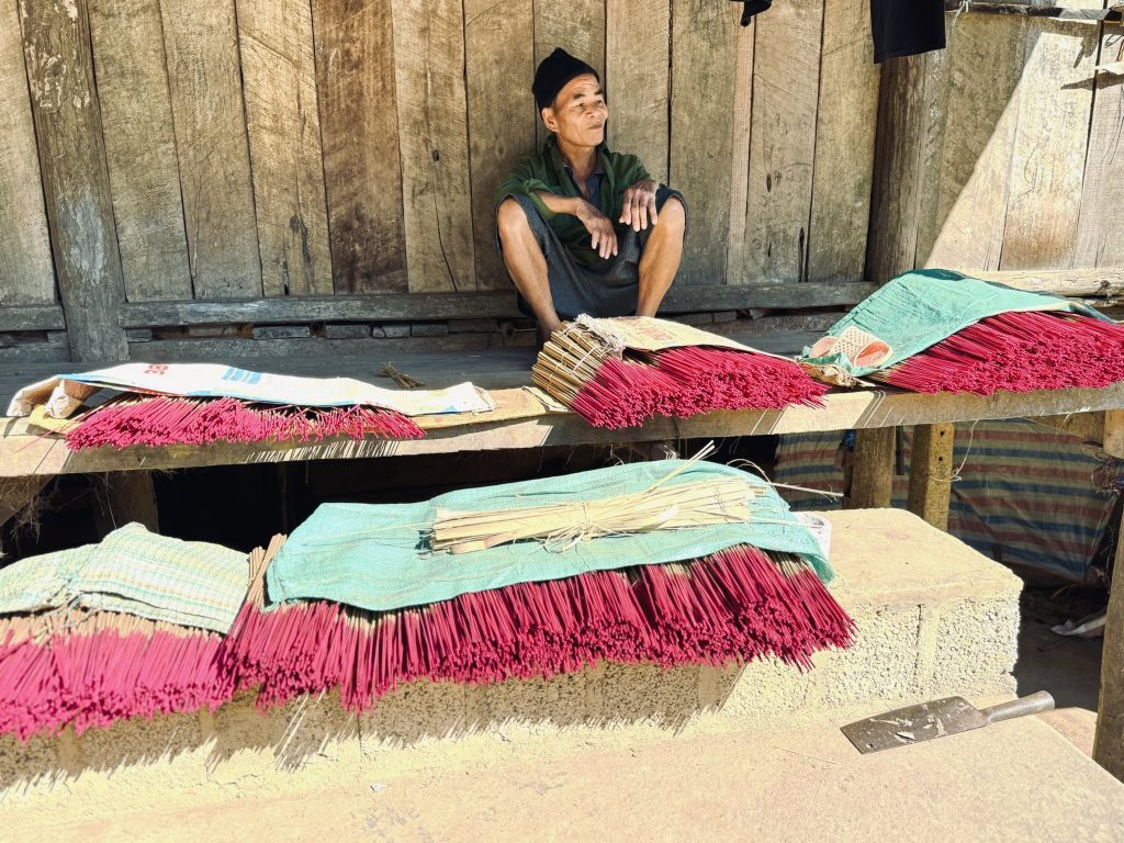
    A man sits against a wooden house with red incense sticks laid out before him

    The more I learn about northern Vietnam’s ethnic minority groups, the more I realise how much the region has to offer beyond its landscapes. I also realise that I don’t need to understand every tradition to appreciate it. 

    Sometimes, travelling well starts with being curious enough to ask questions—and humble enough to know that we won’t always have all the answers.


    Roamwise by Leaf — Practical guides | Forgotten stories | Meaningful journeys
  • The Story of Ha Giang: The History Behind the Ha Giang Loop

    The Story of Ha Giang: The History Behind the Ha Giang Loop

    Most people visit Ha Giang for the road.

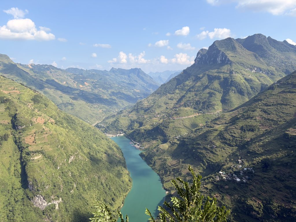
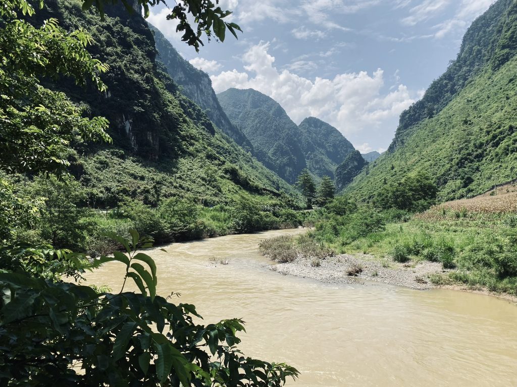
    The famous mountain passes, the Nho Quế River, and the winding route through northern Vietnam have made the Ha Giang Loop one of the country’s best-known adventures. But the road is only a small part of the story of Ha Giang.

    Ha Giang has been shaped by thousands of years of settlement, generations of ethnic communities, its position on Vietnam’s northern frontier, colonialism, and one remarkable road-building project that changed the region forever.

    I’ve always found the people there to be one of the best parts of Ha Giang. They’re friendly, funny and charming, but what I particularly love is how connected people are to the land and its history.  

    So, if you’re planning to ride the Ha Giang Loop, I think it’s worth understanding the story of Ha Giang and what came before the road.

    Because once you know the story behind the road, you see Ha Giang differently.

    The Story of Ha Giang Began Long Before the Loop

    The story of Ha Giang began long before the Loop. The Ha Giang of today is relatively new, but the people who live there are not.

    Archaeological evidence around Ha Giang City shows human activity in the region stretching back tens of thousands of years. Over the centuries, different communities developed across the mountains, adapting their lives to a landscape that is beautiful but far from easy to live in.

    Today, the region is home to numerous ethnic groups, including Hmong, Tay, Dao, Nung, and Lo Lo communities.

    That diversity is one of the first things I think you should understand about Ha Giang.

    When you’re riding through the mountains, it’s easy to think of the villages, fields, and houses as part of the scenery. They’re not. This is a lived-in landscape that has been shaped by generations of people.

    The mountains influenced where communities settled, how they farmed and how they travelled. Markets became important meeting places, bringing together people from different villages and ethnic groups.

    And because Ha Giang sits right on Vietnam’s northern frontier, its history has always been tied to more than just the mountains around it.

    Rice farming continues to shape the landscape and daily life across much of the region. If you’re visiting after the harvest, it’s worth understanding what happens during Vietnam’s agricultural burning season, when farmers clear leftover crops from their fields.

    The Hmong Lords of Ha Giang

    One of the most fascinating chapters in Ha Giang’s history is the story of the Hmong lords who ruled parts of the northern mountains.

    The Hmong have had a strong presence in the region for centuries, particularly around Đồng Văn and Mèo Vạc. The Vương family eventually became one of the most powerful families in the area.

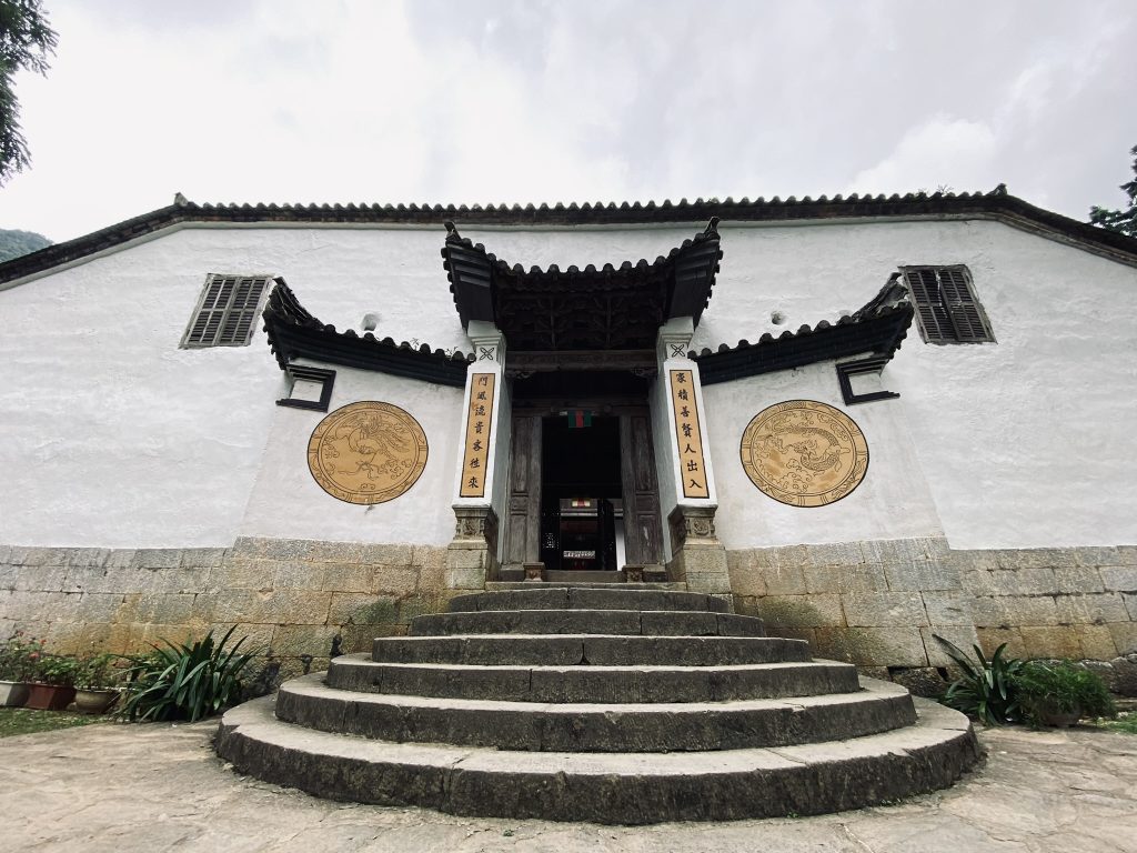
    This is still visible in Sà Phìn, where you can visit the Vương Family Mansion, or the Hmong King Palace as it is also known.

    I’d recommend stopping here on the Loop, particularly if you know a little about what you’re looking at.

    The mansion was built in the early 20th century for Vương Chính Đức, a Hmong leader who became known as the Hmong king. Construction began around 1902–1903, and the complex combines Hmong, Chinese, and European influences.

    It’s a surprisingly imposing building for such a remote mountain valley, with courtyards, stone walls, wooden railings, and numerous rooms arranged around the main complex.

    But the building itself isn’t really the most interesting part, it’s what happened around it.

    Vương Chính Đức had a complicated relationship with the French colonial authorities, who recognised his influence and gave him a military rank. After his death in 1944, his son Vương Chú Sển eventually supported Hồ Chí Minh and the revolutionary government.

    So this one mountain mansion sits right in the middle of several layers of Ha Giang’s history: Hmong leadership, Chinese influence, French colonialism, and the creation of modern Vietnam.

    Once you know that, it stops being just another pretty old building to photograph.

    Visit the Vương Family Mansion, or the Hmong King Palace, to learn more about the story of Ha Giang
    Visit the Vương Family Mansion, or the Hmong King Palace, to learn more about the story of Ha Giang

    Ha Giang and the French Colonial Period

    Ha Giang’s position on the Chinese border has shaped its history for centuries.

    The French occupied Ha Giang in the late 19th century, and in 1891 the area was formally established as a province under French colonial administration.

    The French developed a military presence in the region, but their control was far from uncontested. There was resistance to French rule, including uprisings led by local Dao communities in the early 20th century.

    Ha Giang was never simply a remote corner of Vietnam that happened to be difficult to reach. Its location made it a frontier.

    It sat close to China and far from the centres of government further south, and that isolation shaped the region for generations.

    Eventually, though, one enormous infrastructure project would begin to change that.

    The Happiness Road Changed Everything

    If there is one part of the story of Ha Giang I think every visitor should know, it’s the building of the Happiness Road.

    Today, you’ll know it as the route through some of Ha Giang’s most spectacular scenery. But it wasn’t built for tourists.

    Construction began in 1959, with the aim of connecting Ha Giang City with the remote northern districts of Quản Bạ, Yên Minh, Đồng Văn, and Mèo Vạc.

    Before the road, travelling through this mountainous region was extremely difficult. Communities were connected by footpaths and rough routes, and some journeys could take days.

    Thousands of workers and young volunteers began building a road through the mountains. Much of the work was done by hand, cutting and moving rock through incredibly difficult terrain.

    The project took around six years and was completed in 1965.

    It became known as Con đường Hạnh Phúc — the Happiness Road, reflecting the belief that better connections would bring greater access to education, healthcare, trade, and opportunities for the communities living in the mountains.

    And nowhere is the scale of that project more obvious than at Mã Pí Lèng.

    Mã Pí Lèng: The Road Through the Mountains

    The most famous section of the Happiness Road is probably Mã Pí Lèng Pass.

    Today, it’s one of the defining images of the Ha Giang Loop. The road cuts across the limestone mountains high above the Nho Quế River, and the views are every bit as impressive as you’ve probably seen online.

    But Mã Pí Lèng is also where the scale of the original road-building project really becomes obvious.

    Workers had to carve a route through steep limestone cliffs to connect communities that had previously been extremely isolated.

    So when you’re standing at the viewpoint, look beyond the view.

    Look at the road itself and where it has been cut into the mountain. Then remember that people created that route decades ago using far more basic tools than we have today.

    That’s the bit that stays with me.

    The famous photographs are beautiful, but knowing how the road came to exist makes the experience much more meaningful.

    A winding ribbon of blue marks the Nho Que River through the Tu Son Canyon below the Happiness Road, a major part of the story of Ha Giang
    Mã Pí Lèng Pass overlooks the Nho Quế River

    Ha Giang’s Development from Isolated Mountains to a UNESCO Geopark

    The region’s geology is another important part of its story.

    The Đồng Văn Karst Plateau became Vietnam’s first UNESCO Global Geopark in 2010. The landscape is dominated by ancient limestone formations, with geological evidence dating back hundreds of millions of years.

    But what interests me more than the geology itself is how people have adapted to it.

    This is not easy farming country. Communities have had to make a living on steep, rocky terrain, developing ways of growing crops and living within the limitations of the landscape.

    The result is a place where the natural and human landscapes are closely connected.

    That’s why I don’t particularly like describing Ha Giang as “untouched”, because it isn’t.

    People have been living, farming, and building communities here for generations. In that sense the landscape can’t be untouched.

    So When Did the Ha Giang Loop Become Famous?

    This is the surprisingly recent part of the story.

    The road is decades old. The mountains are ancient. The Ha Giang Loop as an international travel experience is relatively new.

    There isn’t one specific moment when somebody invented the Loop. As roads improved and independent travellers began exploring further into northern Vietnam, the route gradually became known among backpackers.

    By the 2010s, international travellers were increasingly discovering Ha Giang as an alternative to Vietnam’s more established tourist destinations.

    Then social media accelerated everything.

    Photographs of Thẩm Mã Pass, Mã Pí Lèng, the Nho Quế River, and endless mountain roads spread across Instagram, YouTube and travel blogs. 

    More travellers arrived, tour companies developed, motorbike rentals became easier, and homestays opened along the route.

    The Ha Giang Loop became a destination in its own right.

    What’s fascinating to me is how quickly the story of Ha Giang changed compared with everything that came before it.

    For centuries, the mountains made Ha Giang difficult to reach. 

    The Happiness Road changed that. 

    And within a few decades, people from all over the world were travelling here specifically because of the road.

    If you’re looking for an alternative route, read my Northern Vietnam Travel Guide here.

    The People Are Part of Ha Giang’s Story

    It would be very easy to spend four days on a motorbike, tick off the famous viewpoints, and leave thinking you’ve “done” Ha Giang.

    You haven’t. You’ve experienced one route through it.

    The region is still home to communities with their own languages, traditions, markets, festivals, farming practices, and family histories. The people aren’t background props for a motorbike adventure. 

    I’ve found people in Ha Giang to be welcoming, curious, and incredibly self-sufficient, but what stands out most is how much people know about where they live. There is a genuine connection to the land and a pride in its history that you notice when you spend time here.

    Some of my favourite parts of visiting Ha Giang have had nothing to do with the famous viewpoints. It’s the conversations, sitting down for food, being introduced to someone’s family, or listening to a guide explain the story behind somewhere you’d otherwise have simply driven past.

    I once visited a particularly remote village with a guide who couldn’t communicate with the people we met there. They were so self-sufficient and isolated that they hadn’t needed to learn Vietnamese — they spoke their own local language instead. It was a good reminder of just how distinct some of the communities across these mountains are, even from one village to the next.

    That’s why a good guide can make such a difference. They can explain what you’re seeing rather than simply pointing towards the next viewpoint.

    You don’t need to turn your trip into a history lesson. Just be interested in the place you’re travelling through.

    I’ve written more about the importance of festivals and traditions in Vietnam in my guide on the story behind Vietnam’s Mid-Autumn Festival. 

    How I’d Experience the Ha Giang Loop

    After doing the Ha Giang Loop many times, I know exactly how I’d choose to experience it: a small-group tour with an Easy Rider.

    I like the social element of travelling in a group, but I’d look for a smaller one, ideally with a cultural or charity focus that takes you beyond the busiest parts of the Loop.

    You can self-drive, but you need the right licence, confidence, and experience on mountain roads. There’s also Vietnam’s zero-alcohol policy for drivers, and honestly, I’d rather not spend the day wondering what’s around the next bend.

    I’d choose an Easy Rider every time. Feeling safe is important to me, but I also love spending several days with a local person, talking about their life and family, and getting to know the person showing you their home. 

    Whichever option you choose, I’d book through a reputable company rather than choosing purely on price. The right guide can make the difference between simply riding the Loop and actually getting to know Ha Giang.

    And yes, enjoy the rice wine (Happy Water) — just remember that you don’t have to accept every glass.

    💡Roamwise Tip

    Tipping your Easy Rider well at the end is a small but meaningful way of giving something back. 

    Book an Easy Rider and join a culture-focussed small-group tour, treating the journey as an opportunity to actually learn about the story of Ha Giang
    I like to do the Ha Giang Loop with an Easy Rider, treating the journey as an opportunity to learn about the story of Ha Giang

    The Ha Giang Loop Today

    The Ha Giang Loop in 2026 looks very different from the road of the 1960s.

    There are better roads, more accommodation, more restaurants, more tour operators, and significantly more international visitors. 

    The route is now firmly established on Vietnam’s backpacking circuit, and social media has made some of its viewpoints instantly recognisable around the world.

    That has made Ha Giang much easier to visit, but it has also changed the character of the journey. The busiest sections can now be full of tour groups, particularly during peak periods, and the areas around some of the more famous viewpoints have become more developed.

    But the mountains haven’t changed and neither have the communities that have called them home for generations.

    And that’s what I find interesting about the Loop today. You’re travelling along a road that was built to connect remote communities, but you’re now travelling it as part of an international tourism industry that barely existed here a few decades ago.

    The contrast is hard to miss.

    If you’re travelling to Vietnam for the first time, these are 23 things I wish I’d known before I went.

    Ha Giang’s Story Is Still Being Written

    Ha Giang’s history doesn’t stop with the Happiness Road or the arrival of international tourism.

    The region is still changing, and tourism is now part of that story. It has brought income, jobs, and opportunities, but it also puts pressure on the places and communities along the route.

    That’s why I think the way we travel here matters. Ha Giang isn’t a backdrop created for visitors; it’s home to people who have lived here for generations. Respect people’s homes and traditions, support local businesses, and remember that the most photographed places aren’t necessarily the most important ones.

    There’s another recent change worth knowing about.

    In June 2025, Vietnam reorganised its provincial administrative system, reducing the country to 34 provincial-level administrative units. Ha Giang and Tuyên Quang were merged into the new Tuyên Quang Province, which began operating under the new system on 1 July 2025.

    For travellers, this doesn’t mean the Ha Giang Loop has disappeared. The name Ha Giang remains deeply rooted in the region’s identity and in international travel.

    But historically, it’s another reminder that places aren’t fixed.

    Borders change. Names change. Roads change. Tourism changes.

    And Ha Giang has been changing for centuries.

    FAQs About Ha Giang and the Ha Giang Loop

    How old is Ha Giang?

    The human history of the Ha Giang region stretches back thousands of years, with archaeological evidence near Ha Giang City dating back tens of thousands of years. The modern province, however, went through numerous administrative changes before becoming Ha Giang Province in its modern form.

    What is the history of the Ha Giang Loop?

    The roads used by today’s Loop are closely connected to the Happiness Road, a major road-building project constructed between 1959 and 1965. It connected Ha Giang City with the remote northern plateau districts and transformed access to communities that had previously been extremely isolated.

    Why is the Ha Giang road called the Happiness Road?

    The route is known in Vietnamese as Con đường Hạnh Phúc, meaning Happiness Road. The name is associated with Hồ Chí Minh, who visited the region in 1961 and linked the road with the opportunities and improved access it would bring to local communities. 

    When did the Ha Giang Loop become popular with tourists?

    The modern Ha Giang Loop developed as a tourism experience much more recently than the road itself. International interest grew particularly during the 2010s as independent travellers began exploring the region by motorbike, with tourism continuing to expand as the route became better known internationally.

    Who lives in Ha Giang?

    Ha Giang is home to many ethnic communities, including Hmong, Tay, Dao, Nung and Lo Lo people. The Đồng Văn Karst Plateau UNESCO Global Geopark alone is home to 17 ethnic groups.

    Is Ha Giang still a province in 2026?

    No. In 2025, Ha Giang Province was merged with Tuyên Quang Province to form the new Tuyên Quang Province. The new administrative structure officially began operating on 1 July 2025. The historic region and the Ha Giang Loop, however, remain widely known by the name Ha Giang.

    Is the Ha Giang Loop worth doing?

    In my opinion, absolutely — but I’d do it for more than the scenery. The history, communities and people are what make the journey memorable. I’d take an Easy Rider and join a culture-focussed small-group tour, treating the journey as an opportunity to actually learn about the region.

    The story of Ha Giang began long before the Loop
    The story of Ha Giang began long before the Loop

    What I love about the story of Ha Giang is that the thing we travel there for — the road — isn’t actually the most interesting part.

    The mountains were here first. People built lives around them, communities developed their own cultures and traditions, and eventually a road was carved through those mountains to connect them.

    Now we’re riding it for fun. I think that’s worth remembering.

    So yes, ride the Loop, take an unreasonable number of photographs, and enjoy the mountains. But talk to people too. Some of the best moments I’ve had in Ha Giang have come from simply sitting down and listening.

    The Loop might be what gets you to Ha Giang. The story is what makes you understand it.


    Roamwise by Leaf — Practical guides | Forgotten stories | Meaningful journeys
  • Why Does Hanoi Old Quarter Look the Way It Does?

    Why Does Hanoi Old Quarter Look the Way It Does?

    I’ve walked through Hanoi Old Quarter enough times that I’ve stopped noticing some of the things that make it look so unique.

    The ridiculously narrow streets. The buildings that look about three metres wide but seem to disappear backwards forever.  The fact that you can turn a corner and suddenly find yourself surrounded by shops selling essentially the same thing.

    For ages, I just accepted it as Hanoi being Hanoi.

    But once you actually stop and ask why the Old Quarter looks the way it does, there’s a surprisingly good explanation for most of it.

    The streets weren’t laid out randomly. The houses aren’t narrow because somebody was trying to make architecture unnecessarily difficult. And those slightly suspiciously specific street names aren’t just there to rage bait Google Maps.

    They’re clues to the way this part of Hanoi developed.

    The Old Quarter grew as a dense commercial district around the imperial capital of Thăng Long, with craftspeople and merchants settling together, specialising in particular trades and building their lives around them. 

    Later, taxation, French colonial development, war, economic reform, and modern tourism all added new layers.

    So this isn’t really a story about old buildings.

    It’s a story about why the city looks the way it does—and how much of Hanoi’s history you can still see simply by walking down the street.

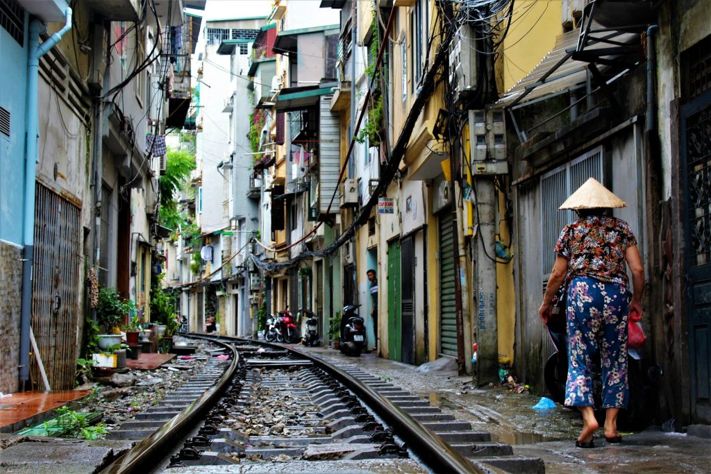
    person walking on railway side between buildings at daytime in Hanoi Old Quarter
    Hanoi Old Quarter grew as a dense commercial district around the imperial capital of Thăng Long

    History of Hanoi Old Quarter

    The area we now call Hanoi’s Old Quarter developed east of the Imperial Citadel of Thăng Long, after Emperor Lý Thái Tổ moved Vietnam’s capital from Hoa Lư to Đại La in 1010 and established the new capital of Thăng Long.

    That move matters because a capital needs more than a palace. People had to live there, goods had to be made and sold, craftspeople were needed, and merchants arrived. 

    Over the Lý and Trần dynasties, the area that is now the Old Quarter became increasingly densely settled as people from the surrounding plains moved into the growing city.

    The landscape was also very different from today’s dense city. The area contained lakes and wetlands, and waterways connected the neighbourhood with Hoàn Kiếm Lake and the Red River before those connections were gradually isolated towards the end of the 19th century.

    Among those arriving were craftspeople and merchants from villages around northern Vietnam, bringing their trades with them. They helped establish the Old Quarter as a dense commercial district where people lived and worked close to one another. 

    These communities also brought their religious traditions with them. Temples, communal houses, and shrines were built alongside the commercial areas, some associated with the founders or patron figures of particular crafts.

    The result wasn’t a neighbourhood that was designed all at once. It was a neighbourhood that grew around the people using it.

    That’s why understanding the history is so useful here. If you only look at the Old Quarter as a collection of old streets and buildings, it can seem chaotic.

    If you look at it as a medieval commercial district that kept evolving for centuries, the chaos starts to look rather more organised.

    Hanoi Old Quarter Streets: What Are They Named After?

    This is probably the easiest bit of Old Quarter history to spot for yourself.

    Look at the street names.

    Hàng Bạc. Hàng Mã. Hàng Gai. Hàng Quạt. Hàng Đồng.

    You’ll notice a pattern.

    Hàng refers to goods or merchandise, and many of these streets took their names from the products or trades associated with the communities that settled there.

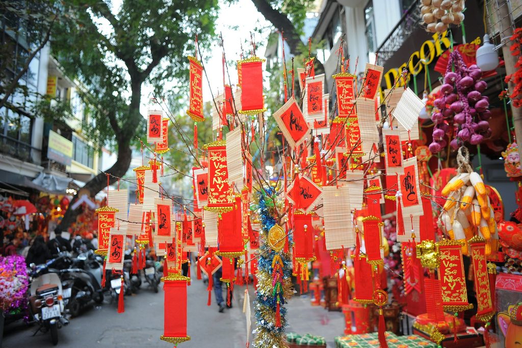
    Hàng Bạc became associated with silver and silversmithing. Hàng Gai became associated with silk and textiles. Hàng Mã became associated with paper goods, including the paper offerings and decorations used for religious and ceremonial purposes.

    This is where the famous idea of Hanoi’s “36 Old Streets” comes from.

    36 Streets of Hanoi Old Quarter

    The Old Quarter developed around specialised craft and trading communities, with different streets becoming known for particular goods and services. 

    People who practised the same trade often lived and worked together, which helped create the clustering you can still notice today.

    There’s a slight complication, though.

    I wouldn’t treat “36 streets” as a literal instruction to go and count exactly 36 modern roads. The historical idea is more complicated than that, and the Old Quarter today contains more streets than the famous number suggests.

    The number isn’t really the interesting bit anyway. The specialisation is.

    Imagine arriving in a city and knowing exactly where to go because one street was associated with your particular trade.

    That’s the logic that shaped this part of Hanoi, and traces of it are still there.

    Some streets have retained much of their historic commercial identity. Others have changed, and some of the original trades have disappeared altogether while the old names remain.

    So when you’re walking through the Old Quarter, those signs aren’t just telling you where you are.

    They’re telling you, sometimes very literally, what people used to do here. And in some cases, what they’re still doing.

    It’s also why one street can still seem to sell an awful lot of the same thing.

    A group of red and yellow decorations hanging from a tree on Hang Ma, Hanoi Old Quarter
    Hang Ma Street in Hanoi Old Quarter

    Hanoi Tube Houses: Why Are They So Narrow and Deep?

    Now we get to one of the Old Quarter’s most recognisable features—the houses. Or, more accurately, the slightly bizarre-looking proportions of the houses.

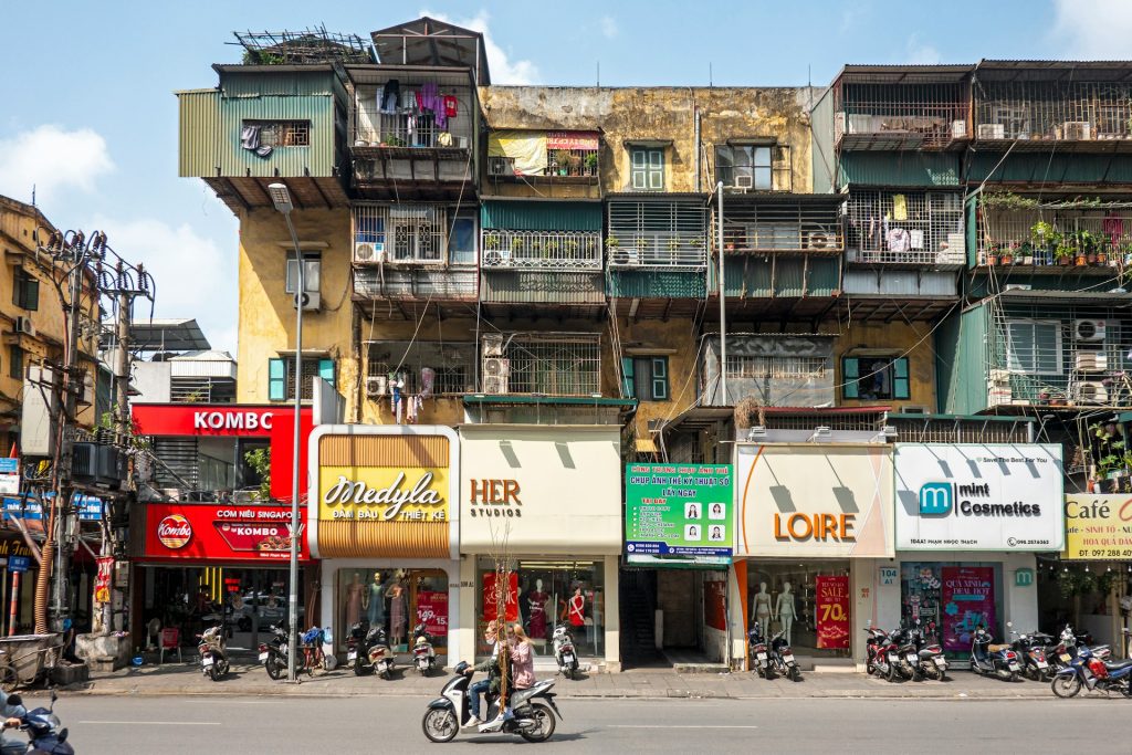
    You’ll often see buildings with extremely narrow façades that extend a surprisingly long way behind them. These are commonly known as tube houses, or nhà ống.

    Traditional examples could be only a few metres wide but much deeper, with rooms arranged sequentially from the street towards the back.

    So why build a house like that? One important part of the answer is taxation.

    One important explanation for the narrow form is historical taxation based on street frontage. If the amount of frontage affected the tax you paid, there was a pretty obvious incentive to keep your frontage narrow and use the space behind it instead.

    It’s an impressively practical response to a slightly annoying tax bill.

    But taxation isn’t the whole story.

    The Old Quarter had become a dense commercial area where land was valuable and buildings had to accommodate both business and domestic life.

    A narrow plot could still be extremely useful because the front of the building could function as a shop or workshop and the family could live further back.

    So instead of spreading sideways, the building grew backwards, which is why the phrase “tube house” is actually quite a useful description.

    From the street, you see the opening, the building continues behind it, and sometimes it continues much further than you’d expect.

    What’s Inside a Hanoi Tube House?

    This is the part you can’t really understand from the pavement.

    Traditional Old Quarter tube houses were often arranged as a sequence of rooms and courtyards running from front to back.

    You could have a shop or entrance area at the front, followed by an internal courtyard, family living areas, another courtyard, a kitchen, and rear service spaces.

    The courtyards were particularly useful for providing light and ventilation to a building that otherwise relied on the light and air from a small shop front.

    The result was a long, layered building rather than one large open house.

    The Mã Mây Heritage House is useful for understanding this arrangement because its restored interior preserves the traditional sequence of rooms and courtyards.

    And once you understand what’s happening inside, the façades outside make much more sense.

    You stop looking at a narrow building and thinking: “That’s a very small house.” Instead, you start wondering: “How far back does that actually go?”

    It’s also worth remembering that the Old Quarter’s age and the age of its individual buildings aren’t the same thing. 

    The tube-house form is rooted in the area’s older architectural traditions, but the buildings you see today have been altered, rebuilt, extended, and replaced over generations.

    So a tall, narrow building might preserve the shape of an older way of building without being an untouched historic house.

    Hanoi Old Quarter Architecture: What Are You Actually Looking At? 

    The Old Quarter’s architecture isn’t one single style, which is another reason why it can be confusing.

    There are traditional Vietnamese shophouses and tube houses, temples and communal buildings, and later buildings where different architectural traditions have been layered together.

    The historic commercial houses often had sloping tile roofs and a shop entrance facing the street. Earlier houses were often simpler and had thatched roofs. 

    Then there are the religious buildings.

    Before 1954, the area reportedly contained more than 100 religious structures, including temples, pagodas, communal houses, and shrines.

    Most haven’t survived. But some have.

    Bach Ma Temple, Mã Mây, and Kim Cổ are reminders that the Old Quarter wasn’t simply a collection of shops. 

    These were communities with their own religious and social institutions, and many craft streets once had temples dedicated to the mythical founders of their trades. 

    Some communal temples even had commercial activity on the ground floor, further blurring the line between the neighbourhood’s spiritual and commercial life. 

    The Quan Chưởng Gate is another surviving piece of the older city. Several gates once stood around the area, but it is the only one that remains today.

    And then, layered over all of this, you get French influence. Which brings us to one of Hanoi’s most useful comparisons.

    A group of people riding motorcycles down a street with tube houses behind in the Old Quarter
    Tube Houses in Hanoi Old Quarter

    Why Does the Old Quarter Look So Different from the French Quarter?

    Old Quarter

    Walk from the Old Quarter towards the French Quarter and the difference can feel almost ridiculous.

    One minute you’re navigating narrow streets between tightly packed buildings, then the roads widen and become tree-lined, and the buildings have grand colonial façades.

    It can feel like someone has changed the city settings halfway through your walk. But the difference reflects two very different periods of urban development.

    The Old Quarter had developed over centuries as a dense commercial area, with streets and plots shaped by existing communities, trade, and settlement.

    During the French colonial period, Hanoi was partially remodelled.

    The French introduced infrastructure including water, sewage, and electricity. A tramway was constructed through the Old Quarter, and two smaller markets were demolished to make way for Đồng Xuân Market.

    French Quarter

    At the same time, the French Quarter developed south of Hoàn Kiếm Lake with much broader streets and larger colonial buildings.

    French and Indian businessmen also established themselves in the Old Quarter. So French influence wasn’t confined neatly to one side of the city. It also made its way into the Old Quarter itself.

    Some traditional houses gained French-inspired façades, balconies, shutters, and decorative elements. That’s where the hybrid French-Vietnamese architecture comes in:

    • A narrow Vietnamese tube-house structure might suddenly have European decorative details attached to it.
    • A traditional roof might sit above a façade influenced by French design.
    • And modern shopfronts can sit underneath older upper floors.

    This is one reason I wouldn’t describe the Old Quarter’s architecture as simply “traditional Vietnamese”. It’s more like layer upon layer of Hanoi’s history occupying the same small amount of space.

    Differences: Old Quarter vs French Quarter

    If you want to understand the difference between the Old Quarter and French Quarter, you don’t actually need to know much architectural terminology.

    Just look at the road:

    • The Old Quarter’s streets are narrow because of how the district developed.
    • The French Quarter’s broad avenues reflect a different approach to urban planning.

    The city itself is showing you the difference.

    What Happened to Hanoi Old Quarter?

    This is where the idea of Hanoi Old Quarter as a perfectly preserved historic district falls apart a little. And that’s probably worth knowing before you visit.

    The Old Quarter is ancient as an urban district, but it has never been frozen in time. The streets, trades, buildings, and communities have all changed over the centuries, so the neighbourhood you see today is the result of many different periods layered on top of one another.

    Many of the traditional commercial houses visible today date from the 18th and 19th centuries, rather than from the founding of Thăng Long in 1010. Earlier buildings were rebuilt or replaced, while later generations continued to modify the houses around them.

    During the French colonial period, parts of the Old Quarter were rebuilt and modernised. Water, sewage, and electricity infrastructure were introduced, a tramway was constructed through the quarter, and two smaller markets were demolished to make way for Đồng Xuân Market.

    The 20th century brought further political and economic upheaval.

    After 1954, Hanoi became the capital of independent North Vietnam. During the Vietnam War, the Old Quarter survived bombing, although some buildings were damaged, including during the 1972 Christmas Bombing.

    After reunification in 1976, Hanoi became the capital of unified Vietnam. The following period of economic difficulty contributed to the deterioration of many old buildings.

    Then came Đổi Mới in 1986.

    Economic reforms opened up private enterprise and helped bring increased commercial activity and foreign tourism. The Old Quarter changed rapidly. More businesses arrived. Tourism grew. Buildings were renovated, extended, and rebuilt.

    And while heritage preservation efforts also increased, many traditional houses have continued to disappear.

    Hanoi Old Quarter Today

    Because of the changes to the Old Quarter over the years, when you walk through it today, you’re seeing several different things at once:

    • Some buildings are historic.
    • Some preserve historic layouts.
    • Some have been heavily altered.
    • Some are much newer.
    • Some traditional trades survive.
    • Others survive mainly in street names.
    • And some of the religious buildings that once formed an important part of the neighbourhood have disappeared completely.

    The Old Quarter isn’t a time capsule.

    It’s a neighbourhood that has spent centuries adapting to whatever Hanoi needed next.

    How to Read Hanoi Old Quarter When You Walk

    This is the part I’d actually use when you’re there.

    You don’t need a checklist or to visit every historic building, and you definitely don’t need to know all of Hanoi’s dynasties before breakfast.

    Instead, try reading the neighbourhood itself.

    Start With the Street Names

    When you see Hàng, look at the word that follows it.

    • What does it mean?
    • What was the street associated with?
    • Does that trade still exist there?

    You might start noticing that the neighbourhood’s commercial history is quite literally written on the signs. 

    Look Above the Shopfronts

    The shops at street level are usually what grab your attention. But try looking up instead:

    • How narrow is the building?
    • Does it look as though it extends backwards?
    • Can you spot French shutters, balconies, decorative details or different layers of construction?

    The upper floors can tell you things the shopfront can’t.

    Look Beyond the Façade

    If you pass a particularly narrow house, try to work out what is behind it.

    You may only see a tiny entrance from the street, but the traditional building form could extend much further back.

    If you visit Mã Mây Heritage House, pay particular attention to the courtyards and the sequence of rooms. Then look at the next tube house you pass.

    It suddenly becomes much easier to imagine what’s going on behind the façade.

    Notice the Temples

    The Old Quarter’s religious buildings are easy to overlook because they’re surrounded by commercial life. But that’s precisely why they’re worth noticing.

    The craft communities didn’t just bring their trades into Hanoi; they brought their beliefs and traditions too.

    A temple tucked between shops is therefore part of the same story as the trade streets.

    Then Walk Towards the French Quarter

    This is the easiest comparison of all.

    Pay attention to space, road width, building width, plot size, the amount of open space, and the relationship between buildings and streets.

    You can physically walk from one urban system into another. And suddenly the question “Why does Hanoi look like this?” becomes much easier to answer.

    If you’re using Hanoi as a starting point for exploring the region, I’ve also put together a Northern Vietnam guide covering more of what there is to see beyond the capital.

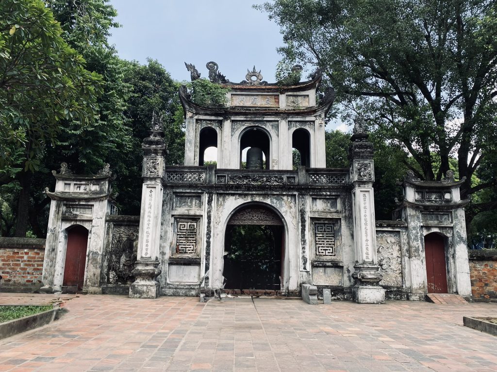
    The front of a temple stands tall with trees surrounding in the heart of the Old Quarter
    The Temple of Literature in Hanoi Old Quarter

    The thing I like about learning the history of a place is that it doesn’t necessarily make the place feel less chaotic.

    Hanoi’s Old Quarter is still busy, the streets are still narrow, and there are still moments when you have absolutely no idea how three motorbikes, a delivery truck, and a pedestrian are all going to fit through the same gap.

    But now I notice different things.

    I notice the street names, I look up at the buildings, I wonder how far the narrow houses extend behind their façades, I notice when a traditional building has picked up French details somewhere along the way.

    And when I walk towards the French Quarter, I notice the change in space rather than simply thinking that the buildings look different.

    That’s what makes the Old Quarter interesting to me.

    You don’t need to find a hidden street or a secret attraction to experience a different side of Hanoi. Sometimes you just need to understand what you’re already looking at.

    And once you do, the Old Quarter stops looking like a collection of random narrow streets and starts looking a lot more like what it really is:

    centuries of Hanoi, still visible in the shape of the city.


    Roamwise by Leaf — Practical guides. Forgotten stories. Meaningful journeys.